Category:Bloomfield, New Jersey
Jump to navigation
Jump to search

township in Essex County, New Jersey, United States   | |||||
| Upload media | |||||
| Instance of | |||||
|---|---|---|---|---|---|
| Location | Essex County, New Jersey | ||||
| Population |
| ||||
| Area |
| ||||
| Elevation above sea level |
| ||||
| official website | |||||
 | |||||
Subcategories
This category has the following 13 subcategories, out of 13 total.
*
B
- Bloomfield (NJT station) (7 F)
- Bloomfield College (4 F)
G
- Grove Street (NLR station) (3 F)
P
R
- Rowe Street (NJT station) (3 F)
W
Media in category "Bloomfield, New Jersey"
The following 41 files are in this category, out of 41 total.
-
-
 9-11 Memorial Bloomfield New Jersey.jpg 1,840 × 3,264; 3.09 MB
-
 Arthur Hornbui Bell in the 1920 US Census in Bloomfield, New Jersey.jpg 2,481 × 1,801; 637 KB
-
 Bloomfield Fire HQ south jeh.jpg 3,480 × 2,296; 1.32 MB
-
 Bloomfield Fire HQ west jeh.jpg 3,974 × 2,309; 1.21 MB
-
 Bloomfield PL jeh.JPG 3,424 × 2,352; 1.44 MB
-
 Bloomfield PO jeh.jpg 2,869 × 2,621; 853 KB
-
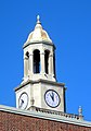 Bloomfield townhall rodunda jeh.jpg 1,487 × 2,121; 538 KB
-
 Bloomfield twp nj 013.png 660 × 580; 58 KB
-
 Bloomfield, New Jersey.png 167 × 300; 11 KB
-
 BloomfieldNJ MorrisCanal.jpg 1,024 × 680; 325 KB
-
 Brookdale Christian Church - panoramio.jpg 3,264 × 2,448; 1.62 MB
-
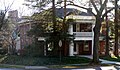 Cadmus House about 2006.jpg 1,926 × 1,127; 1.27 MB
-
 Cadmus House Datestone.jpg 1,681 × 1,199; 997 KB
-
 Cadmus House from the northwest.jpg 1,290 × 807; 120 KB
-
 Cadmus House, from east.JPG 1,917 × 1,399; 1.54 MB
-
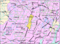 Census Bureau map of Bloomfield, New Jersey.png 575 × 425; 74 KB
-
 Collins House, Bloomfield, NJ.png 524 × 336; 352 KB
-

-
 Essex Jr Academy Bloomfield jeh.JPG 3,716 × 2,246; 1.36 MB
-
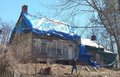
 Farmhouse, Stone House Plains.jpg 1,168 × 821; 396 KB
-

-
 Frank M Leo Assc Bldg Bloomfield jeh.jpg 2,006 × 3,410; 962 KB
-
 Grevestone of Charles Warren Eaton in Bloomfield Cemetery.jpg 1,000 × 835; 921 KB
-
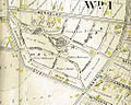 Halcyon Park from 1906 Atlas.jpg 1,000 × 801; 570 KB
-
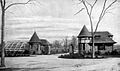 Halcyon Park Gatehouse (circa 1895).jpg 637 × 376; 141 KB
-
 Halcyon Park, Bloomfield, New Jersey, Summer, 2011.jpg 850 × 494; 584 KB
-
 Holstens.jpg 615 × 524; 148 KB
-
 Morris Canal 2nd River cross Blmfld jeh.jpg 2,798 × 2,801; 2.13 MB
-
 Morris Canal 2nd River route Blmfld jeh.jpg 3,997 × 3,168; 2.18 MB
-
 Morris Canal Plaque at JFK Drive and Liberty Street Bloomfield NJ.jpg 3,264 × 1,840; 1.8 MB
-
 MORRIS CANAL, BLOOMFIELD LOCATION, ESSEX COUNTY, NY.jpg 2,784 × 1,848; 1,009 KB
-
 MORRIS CANAL, BLOOMFIELD, ESSEX COUNTY, NJ.jpg 2,784 × 1,848; 1,018 KB
-
 Oakes Mansion jeh.JPG 2,456 × 1,744; 1.13 MB
-
 Oakes Mansion signs jeh.JPG 2,774 × 1,989; 1.27 MB
-
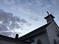
 Park UMC Bloomfield jeh.JPG 2,681 × 3,558; 1.63 MB
-

-
 Westinghouse Lamp Plan cleanup.jpg 4,032 × 3,024; 5.71 MB
-
 Westinghouse Lamp Works Bloomfield, New Jersey Postcard.jpg 384 × 255; 155 KB
-
 Westinghouse plant streets in Bloomfield, New Jersey renamed.jpg 526 × 647; 152 KB
-
 Winners World Championships July 14, 2007.JPG 720 × 956; 92 KB
.jpg)


.jpg)


